Monday, July 23, 2012

Medicine Bow, Wyoming

Medicine Bow in the Snowy Range mountains got its name from the American Indians, too.  They found the mahogany tees in these mountain valleys to be exceptional for bow-making.  The gathering of tribes was much like white folks gathering:  social and ceremonial (or spiritual).  When the Indians came together, the pioneers said they were "making medicine."  Making medicine and making bows became Medicine Bow.

The Snowy Range mountains tower to over 12,000 feet, and you can still find snow on the summits in August!  Vacationers come to this area now for rock climbing.  Vedauwoo (say it like this:  vee-da-voo) is one of the best climbing spots in Wyoming.  Vedauwoo is from the Arapaho word for "earthborn."

America's first national monument, Devil's Tower, is found here.  It's a plateaued "rock" almost 1,300 feet higher than the surrounding land, and looks as though some gigantic grizzly tried to claw it's way to the top somewhere in the mists of time gone by.  There are more than two dozen Indian tribes that venerate this place including the Lakota, Crow, Cheyenne,  Kiowa, Shoshone and Arapaho


(Sorry about the glare, but it's a better picture than I could have taken...  Can you imagine the bear trying to claw his way to being king of the mountain?)  If this image looks familiar, think "Close Encounters of the Third Kind."

Geologists have come up with a dozen different ways this thing might have been formed, but they haven't settled for sure on any of them.  Some think it may have been the plug of a volcanic cone, some think it may be the cone itself.  Most agree it was formed by the forced intrusion of igneous material (think icky thick lava trying to escape through layers of rock that won't give), and then over eons the surrounding material eroded.  I don't have to be a geologist to know this is a pretty cool critter though.

And then there's Fossil Butte National Monument in Lincoln County, Wyoming. 


Did you know that Wyoming was once almost identical to what we now know as Florida?   That's why one of the richest fossil deposits in the whole wide world can be found in land-locked Wyoming.


Who knew?  Now we both do!

Sunday, July 22, 2012

Picking Up The Pieces

As we sit in the van surveying the campgrounds I notice that the RV that had been next to us at last light had left during the night.  Their CAR was still there, but the RV was gone.  Took me a few minutes to figure it out:  they couldn't sleep for all the noise our collapsed tent made flapping in the hurricane winds!  They drove their bed someplace else for the rest of the night.  (I'm so embarrassed!)

Well, there's nothing left to do but pack things up and move on ourselves.

The wind had been so strong that it actually pulled up some of the tent stakes and broke the bungees Granpa had diligently (repeatedly) put in place.  No wonder the tent collapsed.  Nothing but a few bungees damaged though.  No worries.  Another experience for the backpack of life.

As we pull back out onto the road we see where we must have camped before.  Wyoming thought it was such a cool place that they turned it into a conference center.  I guess the muckiety-mucks get that sheltered-from-the-wind place and, if we ever camp at Curt Gowdy again, we get the hurricane...

The drive IS scenic though and ends in a nice surprise.


We intersect the Interstate at an interpretive rest area.  President Eisenhower authorized the Interstate highway's after having experienced Germany's autobahn, and this section must have been completed in 2009, the Sesquicentennial of Lincoln's birth - so they kinda dedicated "The Lincoln Highway" to both Eisenhower AND Lincoln.  (Did you know that every five miles the Interstate has to have one mile of straight road so that planes can land on them in time of war?  That's one of the major reasons Eisenhower wanted the Interstate built - easy troop movements.  It didn't hurt interstate commerce one bit either.)

And speaking of commerce...

The driving (no pun intended) force behind the completion of the Lincoln Highway was a man named Henry Bourne Joy.  He was the first president of the Lincoln Highway Association (1913), is sometimes called the father of America's modern highway system, and, oh, yeah, HE WAS THE PRESIDENT OF THE PACKARD MOTOR CAR COMPANY!  Hello!!  He convinced the government to take our tax dollars and build roads for his cars to drive on.  Pretty clever fellow, eh?  Don't get me wrong.  That's perfectly okay with me.  But without his "leadership," government might not  have built this road.  And what's the payback to me the taxpayer?  Tourist dollars support local economies all over America.  It was a win-win:  Joy made LOTS of money selling his Packards, and we have the "joy" of driving on the roads.

The old dirt roads slowly became paved and evolved into U.S. Highway 30 and then eventually into Interstate 80.

The Lincoln Highway was the first transcontinental automobile road - 3,500 miles of it.  What a joy!

Saturday, July 21, 2012

Let the Storm Begin ... I Guess


Granpa is always seeking out his cooling wind, but this time, ignoring the fact that THERE'S A STORM COMING !!!


These tents are amazing.  Seriously.  They are meant to bend and flex with the wind without actually breaking or tearing stitches.  (Unfortunately, I don't bend and flex as well as I used to.)  Regardless of how gusty and strong the winds got we had a job to do. The lightening, though, was truly frightful!  We had that big ol' metal van sitting slap dab up against the tent to block the wind (not), just teasing and tempting the lightening to strike her.  CRASHING thunder, unbelievable wind!


Once the storm started there was no turning back.  We just hunkered down and rode her out - sort of.  It is always worse to me on the rim at Palo Duro because I could just imagine blowing over the side of the canyon, but next to that, this was as bad as it's ever been.

Along about midnight I see Granpa on his hands and knees crawling out to re-strap some tie-downs.  Three a.m., ditto.  Four a.m. I wake up realizing the tent is laying across my face and there is LOTS of flapping of fabric going on.  Using my always-handy flashlight I look to see how much water is in the tent.  Nada.  That's interesting.  That's good; but that's interesting because with all the rain and wind I can't believe we're not floating!

Five a.m. I surrender, roll out of the cot, grab my purse and some electronics and crawl out from under the mostly collapsed tent on my hands and knees.  I manage to get me and everything I grabbed into the van without dropping anything.  Only minutes later I see Granpa crawling out on his hands and knees, too.

We survived rain and wind and lightening and marriage.  Yes, sirree.  The tent sustained no wounds and neither did our marriage.  However, there is this new battle cry I have when looking for a campsite:  NO WIND!  Breezes, yes; wind, NO!

Thursday, July 19, 2012

Overland to Wyoming

Overland to Wyoming.  Such a simple statement, but when you consider the fact that rivers (the swift, easy, comfortable way to travel) were the super-highways before automobiles,  "overland to Wyoming" said a lot.

Back in the day, this section of trail was known by a bunch of names:

The Taos Trail
Trappers Trail (Mountain Men)
Cherokee Trail (Gold Rushers)
Goodnight-Loving Trail (Cattlemen)

See, you have to learn the vernacular so that when you read about different groups you know that they all mean the same location.  That's what drove me NUTS about the Civil War!  The Union would call a battle by one name and the Rebels would call it by another.

Now we're looking for Curt Gowdy State Park just west of Cheyenne, Wyoming.  We've stayed there before, and it's pretty interesting topography:  huge boulders piled on top of each other, juniper and sage brush, a lake...  We don't even slow down for Cheyenne, but we do take the scenic route shown by roadsigns instead of listening to Lil Miss GPS telling us to take the super slab (Interstate.)  M-m-m-m, it is beautiful, and we always love the pronghorn antelope.


Scurrying around like we might hurt them.  Silly antelope.  We only shoot pictures, not guns, but we understand your caution...


The one on the right looks like Bambi - but Bambi was a deer, not an antelope.

We're remembering the Park to be on the right side of the road, but when we get there it appears to be on the left.  (Get a clue here, Granma.)  We pull down into almost barren hills toward a small lake.  There's an entrance shack, and it's staffed.  The lady says that the other side of the road is closed to campers, but we're welcome to pick a site, any site, and stay here.

John picks THE most exposed site on the highest patch of land around.  (Here he goes with his wind thing again... sigh.)  We've heard weather reports and see storm clouds building, so we're in kind of a hurry to get camp prepared.  (There's a clue here somewhere...)  (Get a clue, Granma!)


Cripple Creek Gold !

After a couple of days in Red River, New Mexico we are ready to move on through Colorado into Wyoming.  We're interested to see if the Colorado Springs wildfires really "destroyed" the city as the news media made it out to seem.

To reach Colorado Springs we go through the oldest town in Colorado, San Luis Obisbo.  (Note to their economic development and historic committees:  I tried to google them and essentially came up with zip.  Lots on San Luis Obisbo in CALIFORNIA, but not Colorado.)  It's a pretty place, visually transitioning from New Mexico to Colorado in landscape and architecture.  I wouldn't mind wandering the streets of downtown, but we don't know what kind of SNAFU's we'll encounter in Colorado Springs, so we move on.

Remember Charles Goodnight of Palo Duro fame?  After his initial cattle drive of 1866, he and his partner ended up just west of Colorado Springs settling 30,000 head of cattle at Rock Canon Ranch.  Over the next two decades those 30,000 head would become over 1 million head of cattle.

Goodnight was here until 1870 when an economic downturn cost him his shirt, and he high-tailed it back to Texas to financially start all over. 

Colorado Springs was established in 1871 by a railroad executive, William Jackson Palmer,  to appease his wife, Queen Meflen. She was a la-dee-da New York fancy pants that wished for more refinement in the West.  Well, duh!  New York had a couple of hundred years of development on Colorado!  Whaddya expect, lady?

So, anyway, Palmer had a plan - and it worked.  Soon the little town filled with authors, painters, and "persons of high breeding" (I wonder if those high-breds realized that they sounded like a bunch of barn yard experiments when it was put like that ??)  To me it's a contradiction, but supposedly the "scenic wonders, healthy climate, and opulent hotels" drew so many Englishmen that it was dubbed "Little London."  Well, I thought London by this time was dirty and dark, full of smog and urban crime...  See what happens when I get to thinkin'?  But it was about this time that Charles Dickens wrote "David Copperfield"...

So Colorado Springs basked in the glow of refinement - until the Cripple Creek gold strike of 1890.
Within ten years the population tripled, but these men weren't wearing starched collars I can tell ya' for sure.  Dusty men, sweating animals, and enterprising money grubbers were the newest citizens.  Unfortunately, after the gold rush waned, Colorado Springs was left to tourism and tuberculosis sanatoriums.

World War II had the next great impact on Colorado Springs, bringing the U.S. military and NORAD (North American Air Defense Command) here.  All these folks turned Colorado Springs into one of the great Rocky Mountain cities.

The much touted wildfires?  We never saw any indication of them from the Interstate and traffic never even slowed through Colorado Springs or Denver.  Though the Air force Academy is practically on the Interstate, and it had been evacuated at the height of the fire threat, we saw no sign of where the fires had been.  Sometimes I worry about the media hyping things to make you watch them...

Wednesday, July 18, 2012

Santa Fe and The Enchanted Circle

Santa Fe, capital of New Mexico,  was originally named La Villa Real de la Santa Fé de San Francisco de Asís (“The Royal Town of the Holy Faith of St. Francis of Assisi”).  ("Santa Fe" is so much easier!)  The Pueblo Indians were the first known inhabitants of the city of Santa Fe, coming to settle there around 1100 A.D.  The Santa Fe River provided ample water for the village - until 1700 when it became seasonal.  In 2007 it became the most endangered river in the United States (or so says the conservation group, American Rivers.) Thanks to modern technology, though, I'm guessin' they'll pipe water in from somewhere so Santa Fe will just go right on being Santa Fe.

In 1608 New Mexico's third governor under the Spanish flag, Don Pedro de Peralta, formally established Santa Fe at the foot of the Sangre de Cristo Mountains.  In 1610 he made it the capital of the Spanish province, which it has almost constantly remained.  That makes it the oldest capital city in the modern United States.  I say almost because Santa Fe had to be abandoned for a dozen years or so (1680-1692) due to deadly Indian raids.  (Ah-ha! So Americans weren't the only ones pushing against Native Americans!)

On it's way to Santa Fe, The Santa Fe Trail takes us to what has become known as The Enchanted Circle.

Anchored by the towns of Taos, Questa, Red River and Eagle Nest, the modern love of snow skiing has added Angel Fire and the Taos Ski Valley.  Circling the tallest mountain of the Southern Rocky Mountains, Wheeler Peak, the Enchanted Circle runs for 84 miles through the (Kit) Carson National Forest.  Because the views are so magnificent: alpine valleys, wild flowers, clear blue lakes, evergreen forests, and historic western communities, what might take you an hour or so to drive will turn into four or more hours!  And that doesn't count the time you spend shopping.

We've been through Kit Carson's adobe home in the heart of Santa Fe.  If you don't do these historic places you miss the real understanding of the times and places.  And read, read, READ the interpretive placards!  WATCH the 7 - 10 - 20 minute videos they show!  LISTEN to the staff, strike up conversations with them to get the minutia that is oh, so interesting!  (Did you know that the Carson home was once used to house World War II German prisoners-of-war?  I guess all those troop ships were coming back to the States empty so why not load up a few POW's and bring them here.  That frees up our troops to fight instead of guard POW's.  I wonder how those folks got back to their homelands after the war??)

During different seasons of the year each town in the Enchanted Circle hosts a variety of entertaining festivals.  You most likely will share the road with bicyclists, too.

Coming from Texas we enter the Enchanted Circle on Highway 64 at Eagle Nest. (My momma and I came through here in 1999 - just before the turn of the century, you know - on our way to Alaska, and just as we top the hill before Eagle Nest we saw two bears.  I have them on video tape somewhere...)


Tuesday, July 17, 2012

Missing the North Pole, South Pole, and Africa

How fun is this!  We have readers on every continent except the Arctic, Antarctic, and Africa!  (If you know anyone on those continents, have them check us out!!)

We now have readers is 25 countries and have had almost 12,000 page views of only 275 posts!  All of this because we wanted to stay in touch with our kids and grandkids at their convenience.

This is kinda fun!  Thanks to all our readers!  I very, very rarely get any feedback, but I guess I must be doing something they like, eh?

And so I blog on...


Ensconced in Junebug Campground

So, we are dry and comfortable in our tent outside of Red River, New Mexico.  The temperatures aren't too hot nor too cold.  The campground isn't crowded, but that may be because the heavy rain over the last couple of days has turned what is usually a crystal clear mountain stream into a fast flowing, milk-chocolate murky river.


On the Fourth of July we go into town to enjoy the local's Independence Day parade.  We love small town parades.  They're the same all over the nation.  At home, we are either in the parade waving to all of our friends and family on the sidewalk, or we're on the sidewalk waving to all of our friends and family in the parade.

(Here, of course, I am in the van trying to figure out why I'm not getting internet connections!)

After the parade there were other entertainments like Indian Inter-tribal dances, Grass dance, Side dance, and an award-winning performance of the dance honoring the revered eagles.  (This is the first time I've tried uploading a video.  Let me know if it works...)


Well, that was enough to wear Granpa out:
That evening we drove back to Eagle Nest for the fireworks show.  I have LOTS and LOTS of photos, but they never translate into the same feeling we have when we watch the celebration in person.  But, trust me, it was one of the longest show we had ever attended - almost 45 minutes!  And they were wonderful displays!

Happy Birthday, America!

( Not bad for a cell phone photo, huh? )

Monday, July 16, 2012

Kit Carson


Not a very smiley face, huh, especially for someone born on Christmas Eve!

I mentioned in "On To The Santa Fe Trail" post that this was the stomping grounds of Kit Carson.  Well, if it hadn't been for ol' William Becknell blazing the Santa Fe Trail back in 1821, Kit's story would have been entirely different.  

Christopher Houston “Kit” Carson was born in 1809 in Madison County, Kentucky, but moved when he was but one year old to Boone’s Lick, Missouri.  Yup, Boone’s Lick as in Daniel Boone.  In fact, the land his family settled on was owned by the Boone family.  Carson and his fourteen siblings became good friends and even intermarrying with the Boone’s.  The Boone’s were also renowned for their gentlemanliness and sense of right and wrong.  Kit's relationships with the Boone family must have had an influence on him because he was always known as a just man.

Kit’s father was killed by a falling tree when Kit was only eight, so Kit never learned to read or write as he had to spend his time hunting to feed the large family.  By age 14 Kit was apprenticed to the Workman’s Saddleshop in Franklin, Missouri.  Franklin was the eastern starting point for the Santa Fe Trail, so Kit got first-hand knowledge of the amazing Far West.

Apprentice’s were legally contracted to their employers for a set amount of time.  Ben Franklin was apprenticed to a print shop as a young man.  (See the posts about him from about a year ago.)  If one left his apprenticeship before the end of their contract the employer could have him arrested.  Kit’s master must not have appreciated Kit’s work because he waited a month before even posting a notice for his return, and he only offered 1 cent reward!  Saddle repair seems to be the only thing Kit was not good at, so I’m certain it was because his heart wasn’t in it.

In 1825, at the age of 16, Kit took a job of wrangling the horses, mules, and oxen of a large trading caravan heading out West on the Santa Fe Trail.  The winter of 1826 Kit stayed in Taos, New Mexico, then known as the capital of the fur trade in the Southwest.  Taos would forever after be Kit’s home, and he is in fact buried there.

In Taos, Kit became fluent in Spanish, Navajo, Apache, Cheyenne, Arapaho, Paiute, Shoshone, and Ute.  Wowser!  That’s pretty cool.

From Taos, Kit accompanied trapping parties into California first and then into the Rocky Mountains.  His first Indian attack was by the Apache on the Gila River.

Kit married twice, meeting both of the Indian women at rendezvous on the Green River in southwest Wyoming.  His first wife was Arapaho, “Grass Singing.”  She died after giving birth to their second daughter, and Kit later married “Making-Our-Road,” a Cheyenne woman, in 1841.  Their marriage was short-lived as she left him to follow her tribe’s migration.  His third choice of a wife was in 1842 at the age of 34.  He married 14-year-old Josefa Jaramillo of Taos.  They ultimately had eight children together and those Carson descendants still live in the Arkansas Valley of Colorado.

This same year Kit met John C. Fremont.  Their relationship is pretty much what history is made of.  They explored, fought Indians and Spainards, mapped, and opened the American West.  Kit took time out from all of this to participate in America’s Civil War.  Yup, that’s right.  New Mexico accepted slavery, but it was geographically not conducive to acquiring slaves, and the government leaders threw their support to the Union.  In 1862 the Confederate Rebels in Texas invaded New Mexico hoping to get Colorado gold and ship it to Richmond to fund their fight against the Union.  The Battle of Valverde ended with a Union defeat and the loss of 68 men with 160 being wounded.  Afterward, most of the Union soldiers were ordered back to the east coast, and Kit and his New Mexico Volunteers were left to deal with “Indian troubles.”

As with the Cherokee “Trail of Tears,” the Navajo were sent on “The Long Walk” in the spring of 1864.  In a 300-mile forced march the Navajo were sent to a reservation set up at Bosque Redondo around Fort Sumner, New Mexico.  The Indians had made a treaty to not war against the whites – but the Indians didn’t equate raiding with war, so they were always getting crosswise with the American army, hence the need to get them to a reservation.  Kit participated in rounding up 8,000 Navajo men, women, and children, so the Navajo held him responsible.  Yes, for finding the Navajo and getting them to the reservation, maybe, but not for the government SNAFU’s that followed.  Even so, into the early 20th century the older members of the Navajo tribe say they knew him to be “just and considerate.”

Toward the end of his life, Kit Carson was reported to be “a gentleman by instinct, upright, pure, and simple-hearted, beloved alike by Indians, Mexicans, and Americans.”  Wow!  Considering the fact that he waged war with all of the above, that is an amazing statement.  Maybe it has something to do with his beginnings…

Kit also fought the west Texas Kiowa, Comanche, Mescalero Apache and Plains Apache.  In 1868, Kit escorted several Ute Chiefs to meet with the President of the United States of America (Hmmm.  That's right after the Lincoln assassination, so it must have been President Andrew Johnson.) and plead for assistance to the Ute tribe.
 
Kit died of an abdominal aneurysm at the age of 58 in May of 1868 Fort Lyons, Colorado.  (That would make him contemporaries with my great-grandfather!)  There have been books written about Kit's exploits, movies, even comic books.  There is a list of places named after him that is too, too long to share here - or maybe anywhere!  He was a pretty cool dude, but he never did learn to smile!


Sunday, July 15, 2012

Texas Claims Santa Fe

In 1836, when Texas seceded from Mexico, it claimed land as far west as Santa Fe.


A few years later, in 1841, some soldiers and traders from Austin, Texas set out with the intention of gaining control of the Santa Fe Trail.  Unfortunately they weren't really prepared and the Mexican army captured the whole lot of 'em.

Texas joined the United States in 1845, setting off a chain of events that a year later resulted in the United States declaring war on Mexico and sending 1,700 soldiers to Santa Fe to claim it and the whole New Mexico Territory for the United States.  Two years later the Treaty of Guadalupe Hidalgo officially ceded New Mexico to the U.S.

So, for about ten years, Santa Fe was a part of Texas!  (Who knew?!  We are born and reared Texans and never knew!  Blogging seems to be very educational, eh?)


Saturday, July 14, 2012

Santa Fe National Historic Trail


Well, as you can see from this National Parks map, we only touched on a bit of the Santa Fe Road around Raton Pass.

In 1821, William Becknell decided he would load up a wagon with goods for sale and set out from Franklin, Missouri headed for Santa Fe.  The road he created would become known as the Santa Fe Road.

His trip was successful financially, and the stories he brought home ignited the wanderlust in a whole lot of folks. 

After the Mexican War in 1846-48, the Road became packed with commerce laden wagons.  In 1855 alone these wagons generated $5 million in trade.  (In 1855!?!  WOW!)  However, this bounty didn't come without a cost of life and limb.  The American Indians didn't much appreciate the encroachment on their homes and hunting land.

It took nearly 200 years to settle "east" America from the Atlantic to the Mississippi River.  It took only eighty years to settle the West.  The focal point for the first forty of those years was the Santa Fe Trail.  In 1866, $40 million worth of goods was carried west in 5,000 wagons.  The population of the Kansas Territory boomed from 8,600 in 1855 to 143,000 in just six years.

It took the railroads to distract travelers from the dusty, long Santa Fe Trail.  In 1880 newspapers headlined the fact that the Santa Fe Road had been lost to the sands of time.  OUR love of history, however, will never let it disappear completely.  Kudos to the National Park Service for recognizing the importance of a path to prosperity and success!

Friday, July 13, 2012

On To The Santa Fe Trail


On To The Santa Fe Trail

We take our favorite highway out of the Palo Duro area, U.S. Highway 287, that runs from Beaumont, Texas all the way to Great Falls, Montana.  That’s almost to the Canadian border!  We love this drive across the high plains of the Texas Panhandle.  I think it’s “uphill” all the way from Vernon, Texas to the New Mexico border.  It appears to be flat, but at the same time you have a sense of great altitude.

This is the Texas where "the deer and the antelope play."


We turn off at Dumas, Texas (I liked this mural painted on the side of one of the downtown buildings),


and head for Texline, hop across the New Mexico border to Clayton and take the southern route into Springer, pick up the Old Santa Fe Trail and move on to Cimarron.  Here are the stomping grounds of names of the Old West like Kit Carson and Annie Oakley.    


From Cimarron we rise into the mountains through the Kit Carson National Forest.  If we’ve been late leaving we usually camp in the forest at Maverick Campgrounds.  Otherwise we rise out of the forest at a plateau called Eagle Nest, New Mexico.  There is a wonderful lake here.  If you’re fans of the old TV show, Jag, you’ve seen this place.  Admiral Chegwidden did some trout fishing here…  Eagle Nest is where several Native American tribal medicine men would gather Eagle feathers for ceremonial purposes.  Charles Springer built a dam creating a 78,000 acre foot lake for irrigation.


 Through Eagle Nest, across the valley floor we pass familiar landmarks like the Loch Ness Monster (our name for it anyway…)   

 
And beautiful log homes, old and new, throughout the valley.

When we reach Junebug campgrounds on the other side of Red River it’s raining.  No worries.  We suspend a tarp from the trees with the help of bungee cords, THEN we put up the tent UNDER the tarp. 

It and we are bone dry!


Wednesday, July 11, 2012

Tracks In The River


Tracks In The River

A stream flows through the bottom of Palo Duro Canyon.  At least it’s a stream until there’s a West Texas cloudburst.  Over the years we have arrived at the Canyon rim only to be told there would be no camping in the Canyon because of the rain.  There’s a nifty private campground right there that we stay in when we have to.  John loves it because there is always a wind on the rim; I’m not too thrilled about it because there is always a wind.  I’m not talking breeze.  I say what I mean, and I mean what I say:  WIND!  This is the kind of wind that lays the tent flat on your face as you lay on the ground in a sleeping bag.  It’s the kind of wind that lifts the raincap of the tent and blows rain in on everything.  And, oh yeah, there’s SERIOUS thunder and  lightening to go with it all.  Rather exciting really.   

We have even set up on the rim and watched helicopters go down into the Canyon to rescue stranded campers!  Fun for us; not so fun for folks who got their things washed down river…  (well, not really “fun,”  maybe “entertaining is a better word.)
 
One time we were in one tent and our brave grandsons of, oh, about 12 years old were in another.  A storm blew up just after everyone said the “Walton” goodnights.  Thunder and lightening to beat the band!  John and I had the granddaughter in our tent.  We tried to talk the boys through the storm.  My, but they really were brave!   If I’d been 12 and over there with no adult, I would have been terrified.  Ultimately the wind demolished the tent and soaked everyone and everything, so we all spent the rest of the night in the van.
Sun dawned bright and early.  We spread the soaked sleeping bags on top of the juniper bushes, and by the time we were ready to load them into the van they were dry as a bone.  Things change quickly in the Texas Panhandle.

But, Back to tracks in the river...


One can get an old west lesson in animal tracking at the stream’s edge.  We can find deer tracks, bobcat, turkey, rabbit, raccoon… well, just about every critter that prowls the Palo Duro.  We could probably even find horny toad tracks (Horned toad to you non-Texans.  Horny toads are an endangered species because of the influx of fire ants from some horrible freighter docking in New Orleans I think.)

So, we’re checking out the edges of the stream and, what to our wondering eyes appear, but a doe and her fawn.  They are beautiful!  She’s not at all concerned about us though she keeps a sharp eye out.


Palo Duro is a marvelous place and our family has made great memories there in the past.  There are many more memories to be made, too!


Blogging On The Go


Blogging On The Go
From Palo Duro to Red River, New Mexico

We are SO going to enjoy this trip!  John can listen to his MP3 player and read his history books; I can lounge around looking at our photos and writing the blog.  You guys are gonna LOVE IT!

Whoa, there, girl.  Not so fast.  You just thought you were gonna blog online.  Guess what?  No 3G signal to be had anywhere in New Mexico except Albuquerque.  Even though we have the MiFi, and it sends a strong signal, and the computer receives it loud and clear, if there is no 3G, there’s no internet connection.  Not even on the iPhone.

Aargh!

So, besides blogging, how am I supposed to handle our personal business, like paying bills and putting our Dish satellite service on vacation hold or check account balances?!  We even have to drive from our campsite beside the trout stream at Junebug campground INTO the town of Red River to get enough phone signal to call AT&T.    

I’m sitting in the van trying to stay connected to the AT&T agent to figure out the problems, and John is strolling through town taking in the ambience.  Sigh.

The third agent I go to without having the call dropped tells me New Mexico isn’t the greatest connection state they have (in a whole lot more words than that!)  However, going through Colorado should make for pretty good connection, and should definitely have no problems in Yellowstone.

She was right about Colorado, but Yellowstone has been a whole ‘nuther story...


Sunday, July 8, 2012

A Newspaper Man Who Could Neither Read nor Write

More on the fascinating life of Goodnight...

Goodnight lived until 1929 - my momma was nine years old when he died, and they both lived in the panhandle.  Cool.  My momma could have KNOWN Charles Goodnight!  When we go to Palo Duro we usually turn off of the highway in a little town called Claude.  That's Goodnight's place, and they're refurbishing his home and turning it into a historic museum.  It should be open in the next year or so, and I would LOVE to go!

Wikipedia says that "Goodnight is also known for rousing and leading a posse against the Comanche in 1860 that located the Indian camp where Cynthia Ann Parker was living with her husband, Peta Nocona, then guiding Texas Rangers to the camp, leading to Cynthia Ann's recapture.[2] He later made a treaty with her son, Quanah Parker."

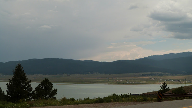
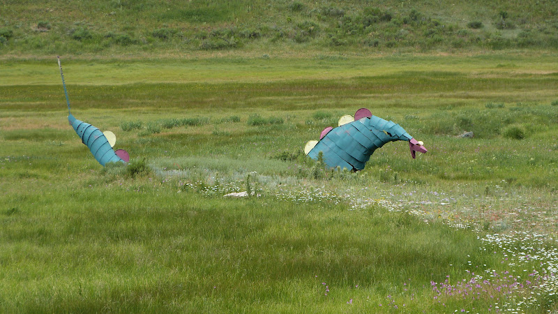
Where we live in East Texas is really close to Fort Parker where Cynthia Ann's family lived (Fort Parker) at the time she was originally captured by the Comanche. Texas may be huge, but we all seem to be connected anyway.  Cynthia Ann's son, Quanah, has a town named after him.  It's just a few miles from my momma's birthplace of Chillicothe.  Quanah hung out in a place sacred to the Comanche, a place called Medicine Mounds.  You could see it from momma's childhood home.  John took a picture of it on our way to Palo Duro:


This photo was from the rest stop that had the rattlesnake warning.  Momma always said Medicine Mounds was full of rattlesnakes and for us to never, ever go there.

Goodnight married in 1870. He developed a practical side-saddle for his wife to use, paid for a Methodist Church to be built in town, established a school for educating beyond the primary grades, and funded a college.

In 1876, the Goodnights preserved a heard of native buffalo (American bison) that survive today in Caprock Canyons State Park in the Texas panhandle. Some of these were taken to Yellowstone in 1902. Some of them also went into large zoos and ranches throughout America. Goodnight also crossbred buffalo with domestic cattle, calling them cattalo

In 1880 Goodnight helped found the Panhandle Cattleman's Association.  (That's a big, BIG deal in Texas!)

Goodnight's JA Ranch ultimately covered a million acres of panhandle real estate. There he crossbred the wild Texas Longhorns with England's Hereford cattle. There was a movie starring Jimmy Stewart and Maureen O'Hara telling that story! (Go-o-o-o-o-d movie!)

His first wife died in 1926.  In 1927, at the age of 91, he married a distant cousin whom he had corresponded with over the years and who had nursed him through an illness following his first wife's death.  A few months before he died he was baptized into her church.  The pastor said that Goodnight had "always been deeply religious and reverential by nature."

During his life, Goodnight had worked as a banker and newspaper man (though he never learned to read or write!), also invested in Mexican silver mines (a losing venture - which ultimately cost him ownership in the JA Ranch...) and for a time lived in Pueblo, Colorado where he even owned a part in the opera house.

Historian J. Frank Dobie said that Goodnight "approached greatness more nearly than any other cowman in history." Goodnight is also sometimes known as the "father of the Texas Panhandle."

If this one man could do all of this in his lifetime without ever learning to read or write, you, me, ANYONE can do ANYTHING if they will just get up and DO IT!


P.S.  After Goodnight left the JA, Tom Blasingame came to the ranch and was to become known as the oldest cowboy in the history of the American west, dying in 1989. Good grief! I was nearly 40 by then! I could have known Tom!

Thursday, July 5, 2012

Palo Duro Canyon State Park

Why is Palo Duro not a National Park?  When applying for National Park status someone apparently sent black and white photos for the presentation rather than color photos (or so the story goes) and Congress wasn't too impressed.  That's okay.  Texas is good with that.  Palo Duro is all ours!


You can scroll down to our earlier post (that would be about 150 posts ago...) to "The Very First Thanksgiving was in ... Texas!"  I suppose that's the beginning of white men in Palo Duro.  The Spanish didn't manage a very good foothold in Texas back in the 1500's, so Palo Duro remained in the hands of the American Indians - Commanche, Apache, and Kiowa - for several hundred years more.

The first thing we see though certainly harken back to the Spaniards:  Longhorn cattle.


Isn't he a magnificent brindle?

And yes, we do still brand out cattle in Texas.  Branding is the only sure way of marking one's stock.  In the wild west, modifying those brands was one of the ways cattle rustlers survived, and they came up with some pretty cool over-branding.


We love camping in the canyon. 


This is a "Texas" tent - intended for maximum breeze capturing.  See how huge that window is?  There's a rain cap that goes with this tent and covers those windows - but we didn't have to use it this night and so, with a very bright, full moon, we watched the stars as we drifted off to sleep.

When we woke up in the morning, standing right outside the window was a deer:


We usually see turkey and certainly racoons.  We didn't see them this time, but one of the other campers said that during the night she had a raccoon trying to work the zipper on her tent...


Tuesday, July 3, 2012

The Best Laid Plans of Mice and Men...

Granpa decided we would leave Monday morning about 5:00 a.m. for Palo Duro Canyon outside of Amarillo.  It's a long drive, but it's a familiar one.  So Sunday after church we pack the van and prepare to head out before dawn - GREAT time to start a trip!  No, really!

I set my iPhone alarm and try to sleep.  About 4:00 a.m. I wake up with a headache.  By 5:00 it was a raging migraine causing dry heaves.  Granpa spent the next half  hour trying to think of everything he could to comfort me: cold cloths to the forehead, neck rubs, Tylenol...  By 6 it had eased a bit, and I guess I went back to sleep.  Around 7 I woke up and told Granpa that, if he didn't rush me and keep things pretty low key, I would try to get the final loading done (ice chest stuff).  What usually takes me 30 minutes took 2 hours - and most of what got done Granpa did.  He is SUCH a treasure!

Our first destination is our son's home in Dallas.  I was unconscious most of the way; Granpa loved listening to his music.  Just before we arrived I sent a text to my daughter-in-law asking if she could have a cup of strong hot tea waiting for me.  I knew she would anyway - I just wanted to be sure, thinking it might help me recover. 

After two cups of tea I'm feeling a bit perkier, and we get a tour of their home.  He has a new projection TV in his home theater room that he's very pleased with.  He keeps trying to talk Granpa into buying one for our traveling as it's not much bigger than two laptops stacked on top of each other, and you can even project the picture onto the side of a tent!  They showed us their aquariums, the four-poster log bed he designed and built, and the walls of artwork our daughter-in-law has done.  Because of my fragile state they chose to leave their Great Dane, Omega, outside.  She might decide to lean against me and I'd fall down!  The grandkids, however, loved on me tenderly, and it was wonderful!

We headed on up the road toward Gainesville, Texas intending to turn due west from there.  I was still not a hundred percent, and when we got to Gainesville there was road construction.  For whatever reason the exit signs had been sanded, and so we missed our turn.  I checked the maps and Granpa decided to head on up into Oklahoma and head west from Ardmore.  (My momma and daddy got married in Ardmore so that was an okay visit by me!)

The highway took us back into Texas around Chillicothe - which is the area my momma grew up in.  We knew we were back in Texas by the warning signs.


We were back on track on Hwy. 287, and I'm feeling much better.  Next stop:  Palo Duro.

Looks like we're gonna make it about 8:30 which is nice because the heat of day will be way past and setting up camp won't be a trial. I had survived the day!


Sunday, July 1, 2012

Now. How to get to Washington State from East Texas?

We've been vacationing in the general Walla Walla, Washington area for decades.  Usually we have nine days to get to "wherever" and back.   This time we will probably take fourteen days to go one way.

Direct, shortest route from Tyler to Walla Walla is 1,959 miles according to one map, and it estimates 30 hours of driving time.  At 2012 IRS rates, it estimates fuel cost to be $1,087.  (That's based on $0.555 per mile.)  We'll see. 

Usually we make a (very) long drive of it from Tyler, Texas to Cheyenne, Wyoming by the way of Oklahoma and Kansas, camp in Curt Gowdy State Park, and then our next stop is the Grand Tetons or Yellowstone.  We're not in a timeframe crunch so, we may mosey around Colorado altogether.

We could go due west into New Mexico and up through Utah and come into West Yellowstone.

We could go up through Oklahoma and all-l-l-l the way through Kansas, into Nebraska, then turn west to Casper, Wyoming.

But they've been forecasting rain for Colorado, so we may dilly-dally around Red River, New Mexico a day or two and then shoot on up Interstate 25 through Colorado into Cheyenne.

These are the reasons I don't want to make reservations in advance.  These are the reasons I like to tent camp because I can stop early or drive til the last 30 minutes of sunlight and pitch our tent then.  We have even set up camp by flashlight...

The temperatures in Oklahoma and Wyoming are going to be really uncomfortably warm; the temperatures in Red River and the Tetons/Yellowstone are going to be really cold - like a low in the 40's!  Cold we can manage as long as we have our "Big Bertha" sleeping bag.  Not much one can do about heat when you're in a tent other than taking a fan.  Plug it into an inverter, and we can run it off the "jump box" or car battery.

Heavy rain forecast for one of these areas - hot or cold - could color our decision, too.  So y'all will just have to stay tuned to discover which way we go.  :-)


Granpa is in the Dog House

Granpa likes woodworking the way I like critters.  He's decided he is going to take some of the leftover log-ends from the construction of our home a few years ago, and he's going to whip together a log dog house before we leave for Walla Walla.

Junior is our Inspector General...


These are leftover from the construction of our cabin.  They are 9" high and 7" thick -  pretty good insulation against heat and cold.


All that is left to do are roof and shingles!


Now. To stain/paint or not to stain? Does the customer want to do his own ? Should we just do a quick sanding ?

Anyone wanna buy a dog house?