Sunday, January 11, 2015

Leaving the Box Canyon of Zion


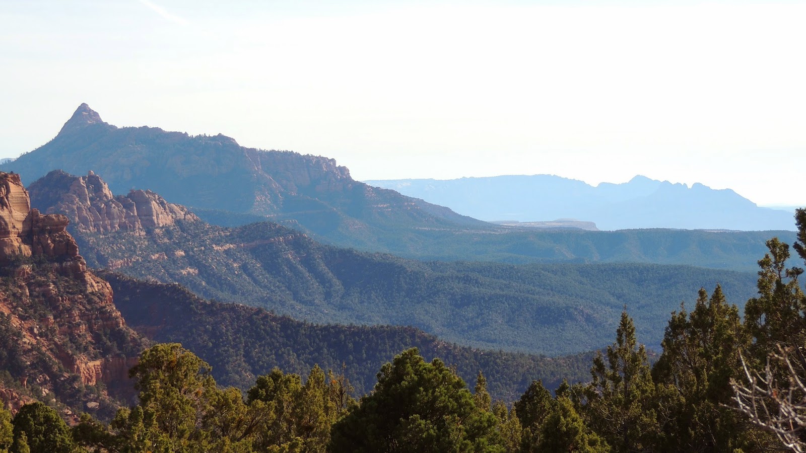
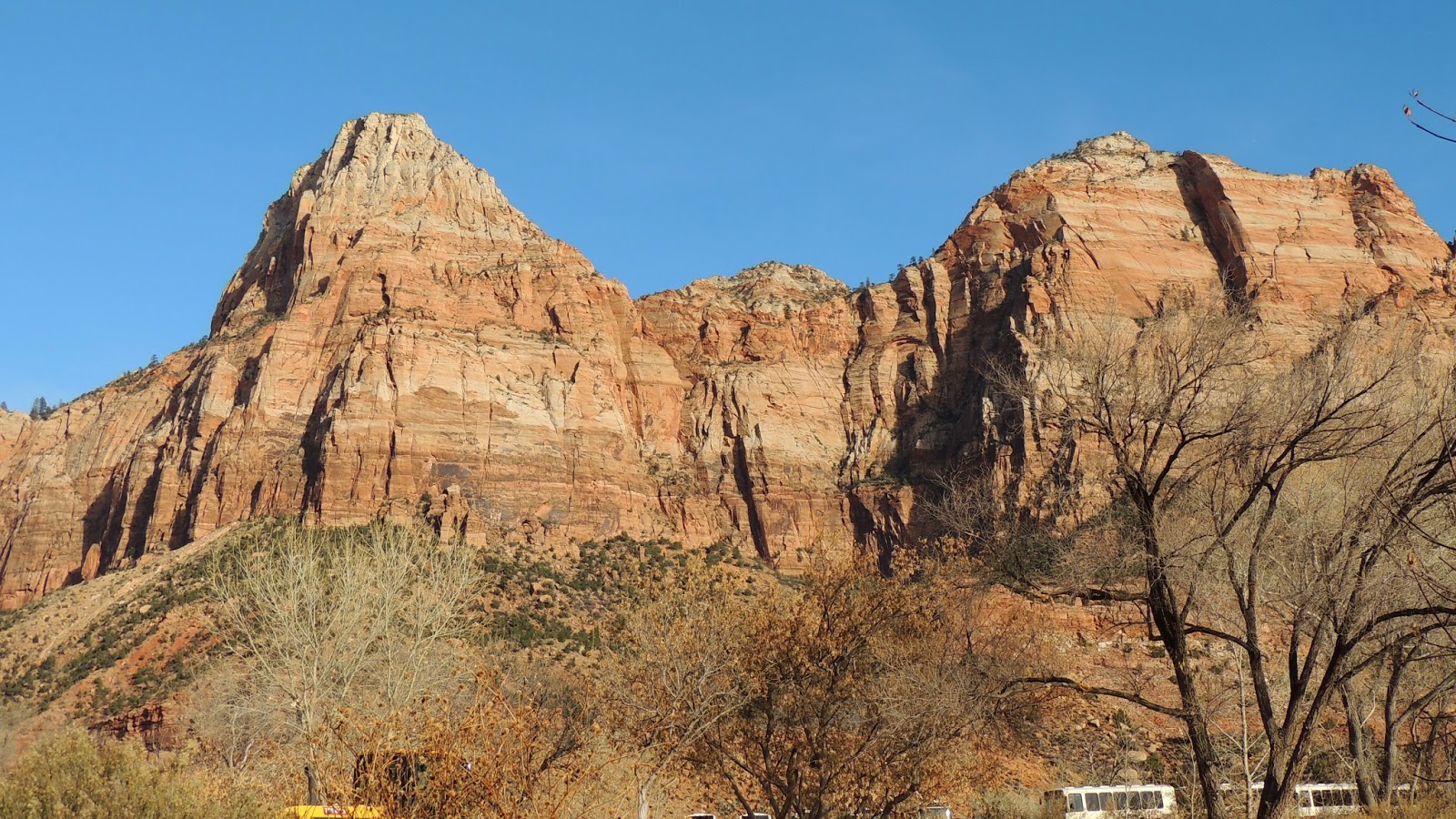
Turning 180 from the last picture in yesterday's blog post you can see how we drove into - and therefore can drive out of - this box canyon.  At our feet is the Virgin River.

I simply cannot get over how drastically and completely the color of the geology changes around here!!


                           I love it !!

So, we're tootlin' back out of the box canyon and are just about to the bridge that would take us to the Grotto, and what do we see?


Now isn't he just simply beautiful??!!  Look at those colors! and the variety of feather's shapes and the way they layer differently!!

Yes, there's a fence behind him, but he's not "fenced."  And he's not alone!


How cool is THAT?  A whole flock of wild turkey, and as healthy as the turkeys our son is workin' his tush off to raise back home.  YUM!!

Well, we need to hightail it outta here 'cause, like I said, it's gettin' nigh onto dark!


Saturday, January 10, 2015

"The Stonebruise" by James C. McCormick

Mercy, how time flies!  When Granpa and I first married, a friend from Dallas, Mary Ladd, phoned to ask if I would be interested in typing up a manuscript for her boss, Jim McCormick.  Typing is to me what playing the piano or knitting is to others, so I said sure.

Mr. McCormick wasn't certain how our long-distance (Dallas to Tyler) transfer of information would work because he didn't trust any electronic stuff.  We ended up mailing edited manuscript back and forth, or I would drive up to Dallas to pick up original copy.

What I thought might take a few weeks at the most turned into several years as he completed his manuscript on a yellow legal pad, in pencil, and as he edited the printed manuscript that I turned out for him. I think I still have some of that stuff on a shelf in a closet somewhere - even after 28 years!

The book was so good that I increased my typing speed exponentially because I just couldn't wait to find out what was in the next sentence and paragraph and chapter!

One of our sons sent me a link a couple of weeks back where I could purchase a copy of that manuscript-turned-book-turned New York Times best seller.  So, I purchased it.

Yup.  It's the right one - just look at the dedication:


It's a historical novel encompassing a young East Texas boy growing up through Roosevelt's CCC camps, through World War II and a friendship with none other than Clark Gable, to his return to Texas and the building of a successful company.  It is, in fact, a sort of autobiography of Mr. McCormick's life. 

At the time that it was published my father-in-law was getting very debilitated by Parkinson's Disease and vision problems. Daddy John had grown up in East Texas, gone to the CCC, and worked with airplanes during World War II - even encountering Jimmy Stewart!  My mother-in-law began reading "The Stonebruise" aloud to him. He was so enthralled with the story that he would have Granny Beth read until she lost her voice!  As soon as she could speak again he would insist that she read more.

As Alzheimer's took over Daddy John's thoughts, Granny Beth cherished that book as a very special time that she was able to share with Daddy John at the end of his life.  That makes the book even more cherished by me, too.

I thank the Lord, and Mary Ladd, for bringing "The Stonebruise" into our lives long, long ago, in a faraway time and place...

Friday, January 9, 2015

Hiking National Parks and the "Box" Part of the Canyon


The National Park Service does their very best to make it possible for each of us to see what God has wrought.  If you ask me though, I think mankind can "wrought" some great things, too!  This walkway and wall are amazing to me.

As you can see by the previous post(s), in a National Park you don't even have to get out of the car to see the wildlife.  But when you realize how non-active you can be and still mosey along to see the sights, maybe you will start to venture out of your homes and towns to quite literally expand your horizons!


They mark the trails, they pave the trails, they even have Ranger guided tours up and down some of the trails.  Also, folks following the same path as you are are quite willing to use your camera and take a picture of you for you.

You can backpack the less traveled ways and even do back-country camping if you happen to be of a more rugged stripe.  The beauty you see from the easy pathway is nothing compare with what you could see if you ventured a bit farther afield.

I believe it was The Grotto that we stopped at years ago.  It was summertime and none too cool.  It was crowded, and people were playing in the Virgin River.  This time it is off-season, very uncrowded, and refreshingly cool.  We drive on past The Grotto, and this time we get to see the "box" part of the canyon.


This is it.  Unless you are a well-equipped mountain climber you will NOT be getting out of this box canyon any other way than the way you came in!!


Well!  Looky here!  Well-equipped mountain climbers!!  And they are way, W-A-Y up there!!


What's really concerning to me is that it's getting on toward dusk.  I have no clue how they think that they can get to the top before the sun fully sets!!  I don't know.  Maybe they're planning on popping open a tent on the side of the mountain and sleeping right where they are!  I know folks can do that. (FOLKS might do that - but not ME!!!)


Wednesday, January 7, 2015

Zion South

It really is beautiful up here.  Kinda has a Smoky Mountain look to it.  See how the mountain range just goes on and on?  That's what fooled the pioneers.  The Smoky and the Appalachia and other eastern ranges were just a row of north to south ranges, up and over and you were done.  Out west, the peaks seem endless.  Wave after wave of mountains as far as the eye could see - north, south, east and west - to cross.  If you were late arriving and there was an early snowfall, it could be the death of you!


It's not too much of a drive at all down to Hurricane, Utah and over to the south entrance of Zion National Park.  Now we're down looking up.


See the buses at the lower right corner?  This entrance leads into a box canyon - one road in, one road out.  In the summertime it gets jam-packed with tourists, so the Park requires folks to take a bus. This is off-season, so we get to drive our own vehicle.  I like.


Tuesday, January 6, 2015

Zion National Park -The Kolob Canyons

There is this magnificent stretch of Interstate 15 between Las Vegas and St. George than my brother told us about.  I think it's the prettiest Interstate drive we've ever made!  Cutting through the mountains of Nevada, Arizona, and into Utah we simply want to stop every ten feet and take pictures!


But, alas, it wouldn't do any good.  You just have to see it for yourself!  You just have to!


Another six days off, another road trip.  Don't cha just love it!  We're headed to Zion National Park this time.  We were there years ago on one of our visits to Bryce - but we weren't greatly impressed. I've been studying maps, though, and there are a couple of entrances to Zion, too, so we're willin' to give Zion a second chance just like Yosemite.

There's this north-western entrance at Kolob Canyon, but it doesn't take us very far into the Park.  It's about ten feet off of the Interstate though, so we'll give it a shot.  Then we'll drop down to Hurricane, Utah and Highway 9 to get to the southern entrance - and come out the eastern exit.  I'm thinkin' that'll pretty well cover everything they have to show us!
It has some pretty stuff to show us:


I would love to hike back into there.  That is what Zion is probably best for - the serious hiker.  I mean, they have over a dozen marked trails that are rated "moderate" or "strenuous."  They sound wonderfully romantic:

Kayenta Trail connects The Grotto to the Emerald Pools;

Taylor Creek Trail (4 hours) is limited to 12 people per group and takes you past two homestead cabins to the Double Arch Alcove -- often snow covered;

Kolob Arch (8 hours) again limited to 12 people and takes you to one of the world's largest freestanding arches -- often snow covered...

And a few sound plum dangerous!  For example:

Hidden Canyon Trail (only 2.5 hours) long drop-offs, not for anyone fearful of heights.  Follows along a cliff face (!) to the mouth of a narrow canyon -- may be snow covered and icy!

Ah, to be young and foolish again!

The Kolob Canyons and Hurricane Cliffs are at the western edge of the massive, uplifted Colorado Plateau (and the south-western corner of Utah.)  Encompassed in Zion you will find Navajo sandstone, Kayenta mudstone (full of dinosaur tracks) Moenave deposits, Chinle shales containing petrified wood, and conglomerate that is composed of Moenkopi rubble.  There are slot canyons that resemble the Antelope Canyons near Page, Arizona (see our post:  http://thetravelerstwo.blogspot.com/2013/10/upper-antelope-canyon.html )...  Just an endless variety of things to see!


Above, you can see from the contrast between the vertical shafts of rock and the tilted rock in the foreground that massive geological changes have gone on here, not to mention the volcanic residue at the top of the formation.  The always gorgeous blue sky does tend to make a pretty picture.


Here we have one of the Cheetos Indians (left over from lunch) admiring the scenery around him.


(Lil' feller really gets around, doesn't he!)


As you can see there are days and weeks and even months worth of places to climb!  But we're moving on to the south entrance to Zion, so it's back to the Interstate for us.

Monday, January 5, 2015

The Icy Road Home

We stopped for a photo of a snow covered cactus because it seemed to be such a contrast.  We were surprised to see a tiny little bird "dancing" around on the cactus and rocks.  (Can you see him?)  We couldn't decide if he was jumping for joy or had freezing feet!


This being a part of the old Route 66, we were not surprised to find this old, old gas station.  It of course has turned into a tourist trap - which was closed because of the weather.  Be it still gave us the gift of a few photos:


Bonnie and Clyde drove one of these, yes?                                      Might be, because this is a cop car!

A bit farther down the road and I had to turn around for this beautiful picture.
The sun had warmed things up just enough to cause a bit of melting 
which instantly froze into icicles.


Take a few steps to the left and this was our last shot of the day.


Sunday, January 4, 2015

We Are Drawn Farther Into The Mountains


Okay.  Now this one reminds me of the frosting on cinnamon rolls!  Now I'm hungry for those forbidden carbs and sugar-loaded, warm creamy frosting!  This is worse than crossing the river!


This is the elevation where the vegetation transitions into trees instead of low-growing cactus and tumbleweed bushes.  It certainly looks like Christmas dreams to me.  We are so completely blessed by the Lord's hand in our lives.  No wonder Christians have an inner peace in the midst of outward turmoil, a peace that surpasses understanding to non-Christians.

Christian or not, I can't get those cinnamon rolls out of my mind, (not that I'm gonna actually eat cinnamon rolls...), so we turn around and head for home.


Friday, January 2, 2015

Thank Goodness For Trains!


Route 66 is icy and there are no other vehicles around in case of trouble.  Can you imagine 18-wheelers loaded with fuel oil - dozens of them - trying to manage roadways in the wintertime?  Isn't it MUCH safer to have a train do it?  Not to mention more reliable!  And folks, it's cold!!  People need their fuel oil and coal delivered to power plants just to stay warm.


There are so many power lines that get between us and good photos.  Granpa and I fuss about them all the time!  But it was less than a hundred years ago that rural areas even dreamed of having electricity available to their homes.  (And Texas Congressman Lyndon B. Johnson's political foundation was his success at getting electricity to rural areas.  Unfortunately, people voted for him for the rest of his life for that one accomplishment and turned a blind eye and deaf ear to the rest of his "accomplishments."  Let that be a lesson to us.)  But back to being snowed in.  Thank the Lord for railroads and power lines - even if they mess up our photos.


Kingman is beholden to the railroads for making them such a success.  Here are a couple of links to a couple of our older posts that mention that:

http://thetravelerstwo.blogspot.com/2013/10/notes-from-museums.html

http://thetravelerstwo.blogspot.com/2013/09/mining-in-mohave-desert.html

Route 66 runs parallel to the railroad tracks.  We saw a half dozen or more trains coming and going as we continued on our snow quest.


Thursday, January 1, 2015

Snow Accumulation in Kingman, Arizona

Apparently, for the first time in decades, it has snowed here in Kingman and there is about a 4" accumulation!  So, of course, Granpa and I had to go take some pictures!  Woohoo!!

Our first thought was to go to the nearest mountains, the Hualapai's.


Hmmm.  Not as much accumulation as we expected - 
but we get a good view of the valley that Kingman is in.  


Aw, bummer.  The cops have a blockade up ahead.  No one is allowed up the mountain unless they have snow chains.  

No worries!  We notice that there seems to be more snow to the west and north anyway - so we head there!

U-turn!


Down the mountain, right on Andy Devine / Route 66 and tis to the north we head!  Love it, love it, love it!


The farther north on 66 we go, the deeper the snow!


And there's MORE!  See ya' tomorrow!!

Bryce Canyon With a Different Camera

Tunnel into Bryce

Window in Bryce


Rudolph


And we're outta here!


So.  Which camera takes the better photos?  This is important, 'cause Granpa's gotta buy another one.

Monument Valley and the Navajo Nation

We have probably all seen these monument mountains in films, magazines, and other media, but did you know that they are not in the good ol' USA?


They are on Navajo land!  This land was set aside in 1868 as the Navajo Reservation with additional land being added in 1884 and 1933.  No one knows when the first Navajo settlement was established here - but it was long before the white man came I assure you!

Before the Navajo, though, the Anasazi (also known as Ancestral Puebloan's) established more than 100 known sites here, and ruins date back to before 1300 A.D.  They abandoned this area and other sites such as Mesa Verde in the 1300's.

The Navajo regarded this place, Tse' Bii' Ndzisgaii, as a huge hogan (traditional Navajo home).  They considered Gray Whiskers and Sentinel pinnacles as the door posts, and the two "Mittens" buttes (those on the left of the photo above) as the hands of their god.

In the mid-1920's a couple of folks set up a trading post (which is still there and selling to tourists!) They hung in there through the Depression that followed the stock market crash of 1929 and two major droughts that drove out a lot of settlers, but they were seriously hurting for money.  A traveler happened to mention that Hollywood was looking for a location in which to shoot a Western.  Harry Goulding and his wife Mike (not a typo) hired a photographer and put together a photo album of Monument Valley.  In 1938, they moseyed on over to Los Angeles, plopped down in that movie studio and said they'd stay there until someone could see them.  And the rest, as they as, is history.  (Talking about creating your own customer base!!)

Director John Ford began filming Stagecoach starring a young galoot by the name of John Wayne in 1939 - in Monument Valley.  Over the next 25 years Ford made seven more films here.  It's been said that these "five square miles have defined what decades of moviegoers think of when they imagine the American West."  But it's not just Westerns that have been filmed here:  Easy Rider, Thelma and Louise, Back to the Future III, 2001: A Space Odyssey, Forrest Gump  have also been filmed in Monument Valley. Oh! and let's not forget the newest one, The Lone Ranger.

In 1958, the Navajo Tribal Council established the five square mile Monument Valley tribal park and opened it to tourists.  Almost half a million folks from all over the world come here every year. (Again with the customer base!)  Monument Valley itself actually covers 91,000 acres in Utah and Arizona.


These are the traditional homes of the Navajo.  The large one on the left is for the man, the one on the right is for the family.  I wonder if the small one on the far right is for ... the dog??

How would you like to have that scenery for your backyard?!

Now, use your imagination a bit here.  This is known as Camel Butte.  I don't know who named this fella, but if it was the Navajo you might wonder how they knew what a camel was.  Well, check out our previous post:  http://thetravelerstwo.blogspot.com/2013/08/camels-in-cavalry.html 


Even with the tourism that the Navajo encourage, about half of them live below the poverty level. Thirty-two percent don't even have complete plumbing in their homes.  You know, sometimes folks realize that they don't need all of what the majority of us consider necessities.  There are more important things in life - like freedom to live a simple life.  As of 2009, the Navajo ran about 80,000 head of cattle, 35,000 horses, and managed almost 200,000 sheep and goats.  No chance of them starving to death.  They have grown crops since the beginning of their existence here, and this seemingly barren valley is on top of an aquifer which allows them to grow those crops.

Most of today's Navajo live in modern housing (though we saw many of those homes had a hogan built nearby.)  Those hogans actually maintain a temperature 25% warmer/cooler than the outside temperature.  We could learn a lesson from that if we were still building our own homes instead of hiring it done.  Almost all of them own their own cars and over half have a high school education or better.  Even more interesting to me is that 83% of them still speak their native language.  THAT is cool!  (Ever heard of the World War II Wind Talkers?)

And here's Granpa, listening to the wind!